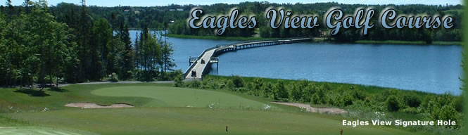
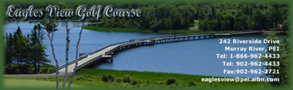
“Eagles View signature hole features the longest bridge over water in Canadian golf”
![]()
| The
Eagles View Interpretive Center, which is located in the Eagles View
clubhouse, highlights the early history and beginnings of the picturesque
community of Murray River. You will be brought back in time as you discover the culture and history of the area and its people. The industries of fishing and farming are still a large part of the community today. |
Interpretative Trail The Interpretive Center also offers trails that wind along MacLure's dam. This 1.5 km trail takes you around the perimeter of the golf course and across the 300-meter bridge that connects the north and south side of the golf course. The Murray River Pines is also located by the MacLure dam. This elegant grove of red and white pines highlights one of PEI's most beautiful settings. This natural area occupies four hectares (10 acres) on the east side of McLure's Pond, at the western side of the village of Murray River. Located on Provincial crown land, the stand is one of the best examples of old growth pine forest with some of the trees dating to pre-1870. The trail is approximately two km in length. Future plans include tennis courts, swimming pool, and a trail system around the pond. |
Brief glimpse of our History:
- In 1808
the MacLure dam was built to provide waterpower for the gristmill and
sawmill. Some buildings are still standing around the dam.
Today there is still a depression in the ground, which stretches right to the shore. This is where a shipyard was located which built the MacLure's vessels before the turn of the century.
- Prior
to the year 1940, there were no refrigerators; some households would
have large blocks of ice cut out of the dam, which would then be stored
in their icehouses. These blocks of ice would be completely covered
with sawdust, which would keep the ice in a solid form until late in
the summer. This was the only way to keep milk and other perishables
as fresh as possible.
- Mussel
Mud was also a business at the MacLure dam. Over time, deep beds of
shell and mud built up in the former estuary. These beds were called
“mussel mud” and contained neutralizing shell and fertilizer
for land, which had become acidic and nutrient poor through years of
farming. Mussel mud was a valuable resource that was harvested and sold
once the ice was strong.
- Enterprising
individuals would haul a digging frame equipped with a mud scoop onto
the ice and using a horse powered capstan, winched in a rope that lifted
a scoop of mud from the bottom to be sold to farmers waiting in line
with their sleigh. The heavy ice only lasted a short time so farmers
would often deposit the mud along the bank for later movement and get
in line for another load.
Site design by PEIslandConnections
![]()